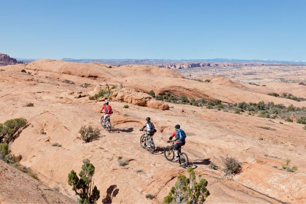
The Slickrock Practice Loop is an iconic Moab mountain biking trail renowned for its unique terrain and breathtaking views. Located within the Sand Flats Recreation Area just a few miles from Moab, this trail offers a taste of the world-famous Slickrock Trail but in a more manageable and less intimidating loop format, making it perfect for both beginners and experienced riders looking for a warm-up or skills practice.
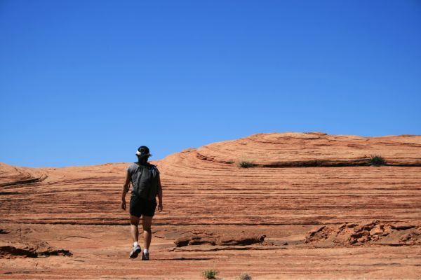
You might be wondering if you can hike this mountain biking trail by now. The short answer is yes; it’s also open for hiking. Here’s what you need to know about this trail.
Table of Contents
Map Of Slickrock Practice Loop
About Slickrock Practice Loop

- Address: Sand Flats Recreation Area
- Trailhead GPS: 38.595228, -109.567011
- Amenities: Vehicle parking, vault toilets, picnic tables, trash cans, information kiosk, and dog-friendly but they must be on a leash
- Level: Hard
- Length: 2.2 miles
- Estimated Time: 50 minutes
The Sand Flats Recreation Area, near Moab, Utah, is located in the Slickrock Practice Loop. The trail’s route is designed to give mountain bikers an idea of what to expect from the main Slickrock Bike Trail in case they decide to take it on. Hikers frequently visit the Practice Loop because of its close proximity to the trailhead and the area’s natural beauty.
What gives it the name Slickrock? The sandstone was dubbed “slick rock” by settlers in the 1800s because horses using metal shoes do not suffer the same tackiness that bike tires do.
Since it was first created in 1969 for motorcycles, mountain bikers have grown to love this track. Mountain bikes and motorcycles are both permitted on the trail, but all four-wheeled vehicles cannot enter.
Guided Tour Of Slickrock Practice Loop
For those looking to ease into the terrain, this trail offers a solid introduction to the kind found on the main loop but at a more moderate elevation. However, it poses some serious challenges and must not be downplayed. True beginners are unlikely to find this trail enjoyable.
Avoid plants, biological soil crust, and potholes. Only use the designated trail to traverse the sandy areas between the slickrock.
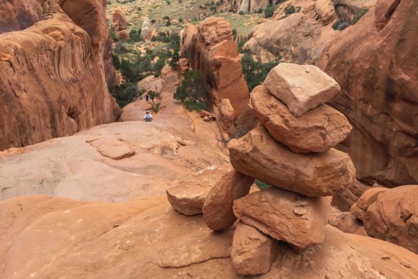
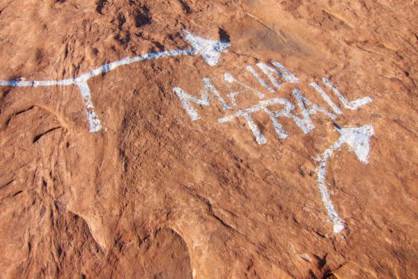
The Practice Loop begins at the painted junction within a quarter mile into the main Slickrock Trail. Take a right at that junction. The slickrock domes of sandstone have many ups and downs that hikers and bikers quickly become accustomed to.
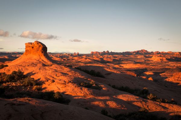
The loop’s initial section circles the hills and more steep cliffs. The picturesque La Sal Mountains frame the eastern horizon, and the northern horizon is drawn to vast vistas of Arches National Park.
After a succession of sandstone domes, follow the white dashes and make a swift descent to the Echo Canyon viewpoint. Stepping off your bike and hiking to the cliff’s edge is well worth it if you want a closer look at this box canyon.
Follow the dashed line as it winds back towards the main route, making several short but sharp rises and declines as it winds up and over several low fins and across sandy washes. After ¾ mile, you’ll re-join the Slickrock Trail. Turn right for the entire loop if you’re game for ten more miles of slickrock. If not, make a quick left turn to head back to the trailhead.
Dogs are welcome; however, it’s not advisable to bring them because the sandstone surface will rip off their paw pads. If you really must bring them, make sure they leave the water in the potholes for the local wildlife and pack additional water.
What To Expect on Your Hike
Before taking on the entire course, beginners might want to consider completing the 2.3-mile Practice Loop. The Practice Loop lets you get a feel for the path without going too far from the trailhead, yet it’s still just as tough as the actual thing.
The trail is an endless sequence of brief but extremely steep ascents and descents. Even though it looks way too steep to ride at first, everything here is rideable after a while because of the amazing traction provided by the granite. If you’re just starting out, start with the easier walks and gradually increase the difficulty because falling on rock hurts more than falling on dirt.
How To Find The Slickrock Practice Loop Trailhead
Turning east on Center Street in Moab and following the signs for Slickrock and the Sand Flats Recreation Area is probably the easiest way to reach the trailhead. Both the Sand Flats pay station and the Moab Visitor Center on Center Street provide maps.
Whether you drive or bike to the trailhead, there is a nominal fee to enter the Sand Flats Recreation Area and access the Slickrock Bike Trail. The “Pay to Play” policy attempts to restore and safeguard the fragile ecosystem that has been harmed over time.
What Time is The Busiest?
The regular riding season on the Slickrock Practice Loop runs from February to November. Some sections of the trail may have ice from late December to early February. Early morning hikes are ideal in the summer when midday temperatures can reach 100 degrees Fahrenheit.
Although this is a well-traveled path for off-roading, hiking, and mountain biking, you can still find some peace and quiet on a slower day. March through November are the ideal months to visit this trail.
Flying A Drone (Is It Allowed?)
It’s allowed to fly a drone above Slickrock Practice Loop. Furthermore, there are many unpaved roads north of Moab that allow you to fly wherever.
Unless you also mountain bike, I believe that flying a drone at Slickrock and Brand Trails would be sort of lame. There are no ledges on the Slickrock Practice Loop, but you can still try it. Still, you might be able to capture some really spectacular footage. Moreover, the trail crosses the Hell’s Revenge Trail at one point, providing an opportunity to capture some footage of the jeeps.
Side Note: You can get UTV and ATV rentals in Moab and take on the Hell’s Revenge Trail.
Additionally, research (or call someone) to see if you can take a drone in Dead Horse Point. There are miles of poorly used trails that go close to the edge of the canyon. It’s possible that you could fly a drone in some of these isolated spots where no one will be there. We don’t know them well enough to be certain, but there might be some paths outside the national park yet still close to the cliffs.
Other Hikes Close To Slickrock Practice Loop
Of course, Slickrock Trail is the closest hike from Slickrock Practice Loop. We all know that it’s a hard trail. So, let’s look at other hikes in Moab that are moderate enough and can give you the best views and experience.
Grandstaff Canyon Trail

- Level: Moderate
- Length: 5.7 miles
- Estimated Time: 2 hours and 30 minutes
The Grandstaff Canyon Trail trek leads to the Morning Glory Natural Bridge, an impressive and famous arch. On the path, you will see intriguing rocks in addition to this sandstone formation. This canyon trail is lined with gorgeous sandstone sculpted by water.
This trail crosses multiple creeks and has several places where you must hike through the water. There are also a couple of brief sections of simple scrambling.
A year-round stream meanders down the canyon, making it manageable even in the warmest months of the year. The good news is that there are enough rocks to keep your feet dry even in the middle of winter, making crossing much of the creek possible.
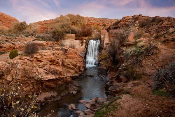
Mill Creek Trail
- Level: Moderate
- Length: 1.6 miles
- Estimated Time: 31 minutes
On a hot day in Moab, the Mill Creek Trail makes for the ideal hike. Overall, it’s not too difficult. The hike will undoubtedly get you wet, but you will be rewarded right away with a gorgeous creek and waterfall.
With very little elevation increase, the entire course just meanders alongside the creek. There’s even a good amount of vegetation and shade!
Hidden Valley Trail

- Level: Moderate
- Length: 6 miles
- Estimated Time: 2 hours and 56 minutes
The Hidden Valley Trail is a fantastic adventure journey through the cliffs to the south of Moab, with two distinct faces. The trail’s first 0.6 mile is a rough, rocky, and difficult climb of around 600 feet. Beyond that, the single-track trail gradually flattens and approaches Hidden Valley on a nice dirt surface with small hills.
If you take your time climbing, you will be rewarded with stunning vistas, peace, and an amazing rock art panel.
What to Bring On Your Hike
When preparing for a hike on the Slickrock Practice Loop in Moab, Utah, it’s essential to bring the right gear and supplies to ensure a safe and enjoyable experience. Here’s a list of items you should consider bringing:
Water: Bring an ample supply of water, especially during the hot and dry months. The desert environment can be deceptively dehydrating, so staying hydrated is essential. There is no water supply available in the trailhead.
Sun Protection: Wear sunscreen with a high SPF to protect your skin from the intense desert sun. Additionally, consider wearing a wide-brimmed hat, sunglasses, and lightweight, breathable clothing that covers your skin to prevent sunburn.
Sturdy Footwear: To navigate the slickrock terrain safely, wear sturdy hiking shoes or boots with good traction. The rocks can be abrasive, so closed-toe shoes are recommended to protect your feet.
Navigation: Bring a map of the area or a GPS device to help you navigate the trail. While the Slickrock Practice Loop is well-marked with white dashes painted on the rock, it’s always a good idea to have a backup navigation method in case you lose track of the trail.
Snacks and Food: Pack lightweight snacks and food to refuel during your hike. Energy bars, trail mix, and fresh fruit are good options to energize you.
First Aid Kit: Carry a basic first aid kit with essentials like adhesive bandages, antiseptic wipes, pain relievers, blister treatment, and any personal medications you may need.
Emergency Essentials: Bring a fully charged cell phone, a whistle, and a flashlight or headlamp with extra batteries in case you need to signal for help or hike after dark.
Weather Appropriate Clothing: Check the weather forecast before your hike and dress accordingly. Even in the desert, temperatures can vary widely throughout the day, so layering is key. Bring a lightweight jacket or rain shell in case of unexpected weather changes.
Backpack: Carry all your gear and supplies in a comfortable, well-fitted backpack. Make sure it has padded straps and a waist belt for added comfort, especially if you’re carrying a heavy load.
Trash Bag: Bring a small trash bag to collect litter or waste generated during your hike. This will help keep the trail clean. You can dispose of the trash you’ve collected once you get back to the trailhead, where there are dumpsters.
What People Are Saying About Slickrock Practice Loop
Slickrock Practice Loop is designed to prepare you for the main Slickrock Trail, but lots of hikers and mountain bikers also find it astonishing. Here’s what others are saying:
Great way to conclude the day hiking on the very rolly slick rocks. Lots of fun with the puppy running up and down the trail.
Corey Flannery – AllTrails
Fun riding and a great way to get exposure to…exposure. If you ever get a chance head out to Moab, when it isn’t blazing hot, rent a bike and have a great time! It’s a great spot.
MTB – Reddit
I guess you could call the Practice Loop practice if you figure that running a quarter mile is a rehearsal for running a mile. There really little difference in the trails other than the length and the ease of bail out. Like Slickrock Trail proper, it’s scenic and fun. It is a little too short to be a real ride; combine it with the Main Loop for a meaty ride.
Another Header
Take The Challenge On Slickrock Practice Loop
The Slickrock Practice Loop is an excellent location based on what is advertised. It helps you get a decent idea of what it’s like to ride over the fins and domes and experience the seemingly never-ending ups and downs of riding steep portions of slickrock.
While the Slickrock Practice Loop is relatively short compared to its big brother, the Slickrock Trail, it still offers plenty of excitement and adventure. It’s a great introduction to riding on slickrock terrain and provides an opportunity for riders to hone their skills before tackling more challenging trails in the area.
If you want to experience it for yourself, grab your bike or go for a hike.
Slickrock Practice Loop FAQs
Can I hike the Slickrock Practice Loop?
Yes, you can hike the Slickrock Practice Loop. While it’s primarily known as a mountain biking trail, it is also open to hikers. Many people enjoy hiking this loop to experience the unique slickrock terrain and stunning desert landscape.
Is Slickrock Practice Loop hard?
The difficulty of the Slickrock Practice Loop can vary depending on your hiking or biking experience and fitness level. While it’s considered a beginner-friendly trail compared to the full Slickrock Trail, it still involves navigating steep inclines and descents over rugged slickrock terrain. With proper preparation and pacing, most people should find it manageable.
Are e-bikes allowed on the Slickrock Practice Loop?
Yes, e-bikes are allowed on the Slickrock Practice Loop. The Sand Flats Recreation Area, where the loop is located, permits e-bikes on designated trails, including the practice loop. However, following all posted regulations and being courteous to other trail users is essential.
What is the main difference between Slickrock Practice Loop and Slickrock Trail?
The main difference between the Slickrock Practice Loop and the full Slickrock Trail is the length and difficulty. The Slickrock Practice Loop is a shorter, more manageable loop designed for beginners and those looking to warm up or practice their skills on slickrock terrain. In contrast, the full Slickrock Trail is longer and more challenging, with steeper climbs and descents, making it better suited for experienced riders.
What is the best beginner mountain biking trail in Moab?
The Bar-M Loop is one of the best beginner mountain biking trails in Moab. Located in the Bar-M Chuckwagon trail system, this beginner-friendly loop offers scenic views of the surrounding red rock landscape and relatively smooth terrain. It’s a great introduction to mountain biking in Moab with fewer technical features than trails like the Slickrock Practice Loop or the full Slickrock Trail.