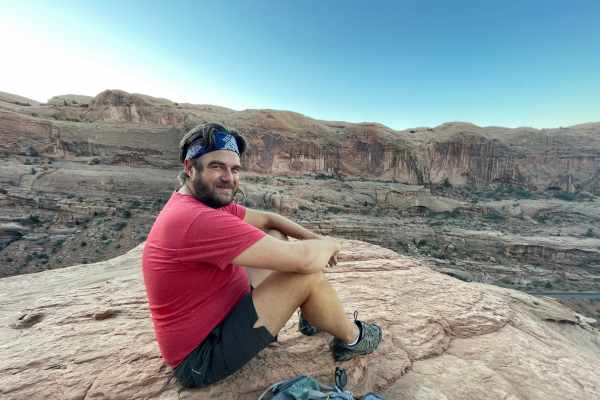
Sun-baked sandstone sculpted into fantastical shapes, deep canyons carved by ancient rivers, and panoramic vistas that stretch to the horizon – Moab, Utah, is an outdoor adventurer’s paradise.
But with so many trails to choose from, where do you begin?
This guide shows off the hidden gems and iconic landmarks, offering the perfect hike for every level of experience and thirst for adventure.
Lace up your boots, grab your camera, and prepare to be awestruck by the captivating beauty of Moab’s diverse landscapes because we’re showing you the best hikes in Moab.
Map of Hikes in Moab
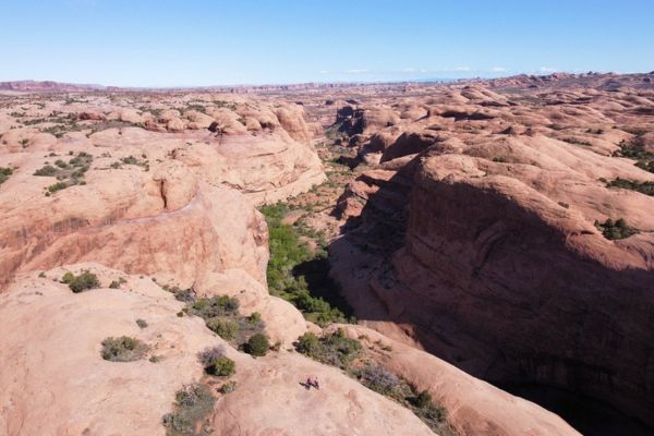
Take An Easy Hike In Moab
Even if you’re not a seasoned hiker, the breathtaking scenery of Moab is calling your name. Easier hikes allow you to experience the beauty of Moab’s natural landscapes without strenuous exertion. Easy level hikes are perfect for families with young children, older adults, or anyone who wants a leisurely outdoor experience.
Moab’s easy hikes often lead to iconic landmarks like Landscape Arch, and Park Avenue Trail, offering you stunning views and incredible photo opportunities without a long and challenging trek.
Grand View Point Trail
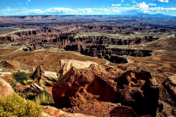
- Level: Easy
- Length: 1.8 miles
- Estimated Time: 41 minutes
Explore this 2.9-kilometer track that circles back into Moab, Utah. Since this is a very well-liked hiking and walking destination, you will probably run into other visitors while exploring. The route is lovely to explore at any time of year and is open year-round. Dogs are prohibited on this trail, so you must leave your pups at home.
The views were amazing. The hike was easy and well worth it. You could see for miles. I highly recommend
rhettkiner from Tripadvisor
Landscape Arch Trail
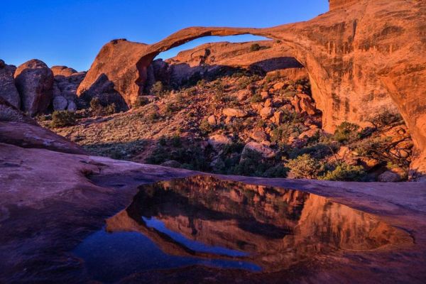
- Level: Easy
- Length: 1.9 miles
- Estimated Time: 49 minutes
Landscape Arch is located in Arches National Park Devils Garden, which is 18 miles (28 km) from the park’s entrance in the northern part of the area. Restrooms are available at the trailhead, and drinking water is accessible from Spring through Fall.
This is one of the most fragile arches in the park and as such you can’t actually get to it, but the trail leads you along the sand to a perfect viewpoint where the arch is highlighted by the blue sky behind it.
Richard N from Tripadvisor
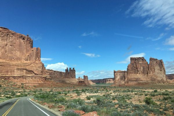
Park Avenue Trail
- Level: Easy
- Length: 1.8 miles
- Estimated Time: 50 minutes
One of the first trails you’ll come to when you enter Arches National Park is the Park Avenue Trail. Even if there are no views of the famous arches from here, there are still lots of breathtaking rock formations to admire. There is an observation platform and a rather easy hike, though some people might be discouraged from hiking due to the steep staircase.
I am so happy we decided to do this trail in the morning. It’s straight down but then levels out nicely. The canyon was very skyscraper-like. Breathtaking!It’s one of those hikes where you stop serval times and just say WOW!
margaret k from Tripadvisor
Short-On-Time Hikes In Moab
Short on time, but want to experience hiking in Moab? Below are some short-on-time hikes that range from easy to moderate. These are the perfect hikes for you if you’re staying for just a few days in the city.
With these short hikes, you’ll have the chance to do other things in Moab, like mountain biking, paddleboarding, and/or finding the best Mexican food!
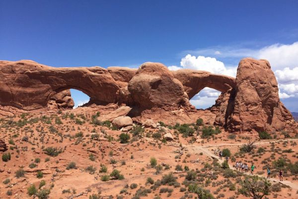
Windows Loop Trail
- Level: Easy
- Length: 0.7 miles
- Estimated Time: 18 minutes
When visiting Arches National Park, this loop is an absolute must-visit. You can stop along the route to admire the magnificence and beauty of three magnificent arches!
Standing squarely beneath the enormous North Window Arch, you can take in expansive vistas of the vibrant desert to the north and northeast. The South Window Arch seems to be perched on a platform, elevated above the arid ground. Hike around the loop, stopping at the captivating formation along the Turret Arch route, before returning to the parking area.
There are three different trails that are interconnected leading to/from what is called the Windows Section of Arches National Park. Very easy trails with lots of shade. Bring water.
DontStopExploring from Tripadvisor
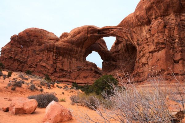
Double Arch Trail
- Level: Easy
- Length: 0.6 miles
- Estimated Time: 16 minutes
Double Arch is a striking landmark that can be seen from the parking loop at The Windows. Its base is reached by a route with a gentle slope. This is one of the Arches National Park’s most picturesque areas and has a high concentration of arches.
Just over two square miles are home to North Window, Turret Arch, and Double Arch, to name a few. The Parade of Elephants, Elephant Butte, and Garden of Eden are some of the other named attractions in this area.
It looks pretty cool from a distance, but as you get closer, you gain a different perspective and can really appreciate the beauty and uniqueness of these two arches together. It is a short , mostly flat walk to the arches but still a very hot one so be prepared with water. It is is an amazing experience getting up close to these arches and being able to climb it.
DLP from Tripadvisor
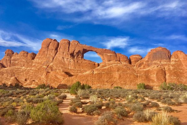
Skyline Arch Trail
- Level: Easy
- Length: 0.4 miles
- Estimated Time: 9 minutes
There’s an arch in a high wall after a short, out-and-back hike on this well defined trail. The walk starts with a mildly rocky ascent and proceeds on a comparatively level path to the base of the arch.
In 1940, Skyline Arch experienced an abrupt collapse of a huge boulder, nearly doubling its original opening. About 0.2 miles (0.3 km) down the route, near the base of Skyline Arch, you can see the remnants of this rockfall.
This was our first trail we walked on and honestly our favorite spot to just relax at. We sat on the rocks back there just soaking up the sun for an hour and only three people walked back to see the arch. You can also see the back of the arch if you’re at the devils garden campgrounds
Cheyenne Rae from Tripadvisor
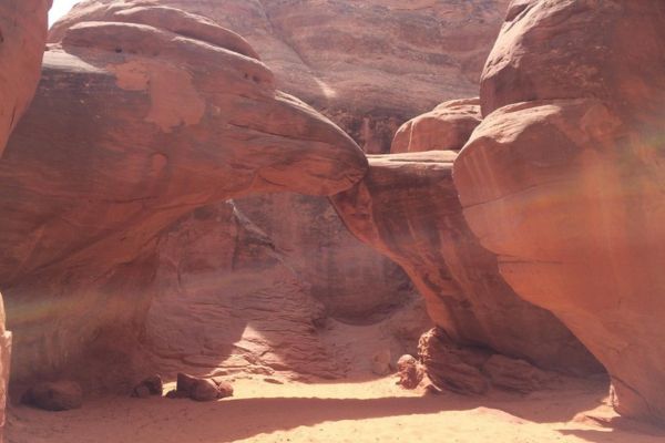
Sand Dune Arch Trail
- Level: Moderate
- Length: 0.3 miles
- Estimated Time: 13 minutes
Search for this hidden archway between towering sandstone walls by wading through deep sand. Wheelchairs cannot access this mainly flat trail because it passes deep sand and has one very tight section.
This arch is located through a narrow walk in the rocks. There is plenty of sand at the base for kids to enjoy. Further along, climbers can enjoy a little bit of challenge.
Margaret L from Tripadvisor
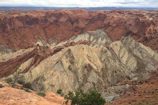
Upheaval Dome First Overlook via Crater View Trail
- Level: Moderate
- Length: 0.7 miles
- Estimated Time: 19 minutes
There is relative geologic order in Canyonlands. Sedimentary deposit layers methodically document historical events in the park. These layers—with a few notable exceptions—have not undergone substantial alterations, tilts, or folds in millions of years.
But it’s a whole different tale for Upheaval Dome. Approximately three miles (5 km) across, there is a significant deformation of the granite layers. The rocks are forced upward into a circular formation known as an anticline or a dome in the center. A syncline, or downwarp in the rock layers, envelops this dome.
What led to the Upheaval Dome folds? This distinctive geologic structure is discussed in exhibits at the trail’s end.
You can only view this only by doing a hike. There are 2 observation points; we heard the first overlook was sufficient, so we went there. The view is amazing and there’s still a mystery how this was actually formed.
Dean_Amy-2004 from Tripadvisor
Poison Spider Dinosaur Tracksite Trail
- Level: Moderate
- Length: 0.2 miles
- Estimated Time: 9 minutes
At Poison Spider Dinosaur Tracksite, you can see the footprints of about ten different meat-eating dinosaurs. The footprints are found on two slabs of rock that fell from the cliffs’ uppermost sandstone.
The 0.3-mile Poison Spider Dinosaur Tracksite Trail is situated west of Moab, Utah, along Potash Road. The moderate hike begins at the trailhead, which offers views of the Colorado River. The path is open all year round. This trail is open to dogs, but they must be leashed.
We stopped at this trail and decided to do the hike to the top to see the Dinosaur prints. It was tough and not well marked. There were other groups there too. It is quite rough and walking sticks definitely helped me. I would do it again. Loved the sites you were able to see from the top.
Cheryl F from Tripadvisor
Work Up A Sweat With These Moderate To Challenging Hikes In Moab
These are some moderate to challenging hikes in Moab that are perfect if you already have the experience and are confident in your skills. This list includes Corona and Bowtie Arch and the Delicate Arch Trail, which is probably the most famous hiking trail in Moab.
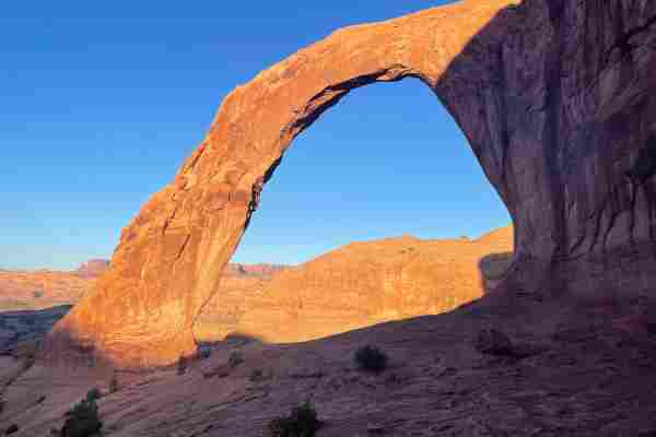
Corona And Bowtie Arch Hike
- Level: Moderate
- Length: 2.3 miles Out And Back
- Estimated Time: 2-3 hours
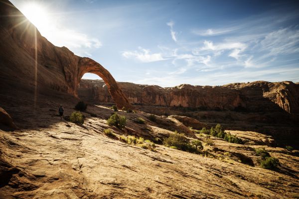
Corona Arch Trail, located just outside Arches National Park, is one of Moab’s most popular and rewarding hikes. Corona Arch Hike might be our favorite hike in Moab.
Corona Arch is a stunning natural sandstone arch with a span of 140 feet and a height of 105 feet. It stands majestically at the end of the trail, offering jaw-dropping views.
Get there early to watch the sun peak over the rocks! It will be one of the most incredible experiences of your life. All Trails says Corona Arch is OK for dogs but this is not a good hike for dogs. I’m so glad Henry stayed in the van.
Delicate Arch Trail
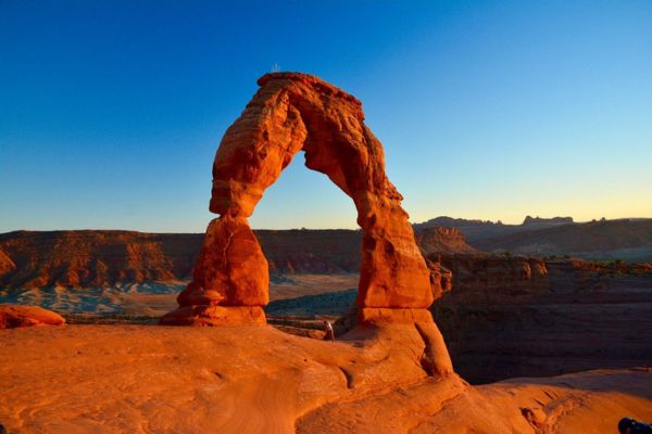
- Level: Moderate
- Length: 3.2 miles
- Estimated Time: 1 hour and 35 minutes
Travelers to Arches National Park come from all over the world, and a major priority for many is seeing Delicate Arch. This specific free-standing arch is one of the most well-known natural structures in the world and a widely recognized icon of the state of Uta.
First recorded in an article about the Arches National Monument Scientific Expedition published in January 1934, the word “Delicate” referred to “the most delicately chiseled arch in the entire area.”
Definitely impressive Arch. Most of the NP photos picture this arch. I typically stick to easy hikes, this was moderate, maybe even strenuous. The challenge was mostly all uphill going and the last part of the hike was over narrow ledges. You don’t see the arch until the end of the trail.
Sara T from Tripadvisor
Grandstaff Canyon Trail
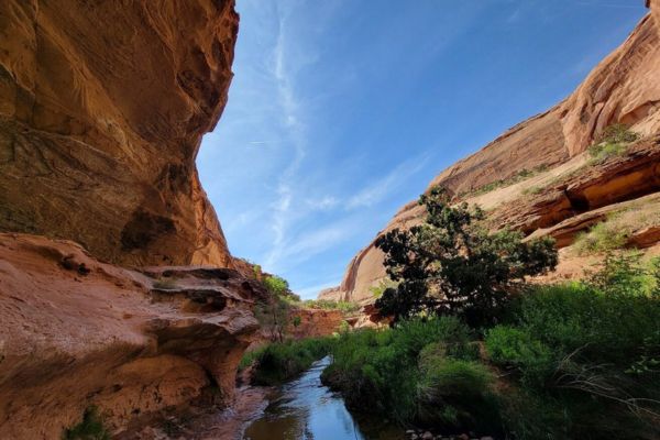
- Level: Moderate
- Length: 5.7 miles
- Estimated Time: 2 hours and 30 minutes
The Grandstaff Trail is a well-liked half-day hike in the Moab area, named after an African-American prospector, William Granstaff, who grazed animals here in the late 19th century. Entering this small desert canyon is not too tough, and most people can manage the four miles round way. The stunning Morning Glory Natural Bridge and a year-round, crystal-clear stream can be found along the trail.
It really is a great hike. It’s hot and exposed to the sun so bring water! Also- SO Much poison ivy. Wear long pants !
3 generations traveling together from Tripadvisor
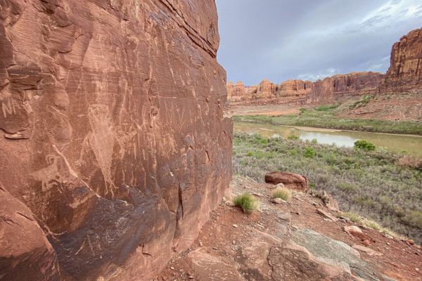
Mill Creek Trail
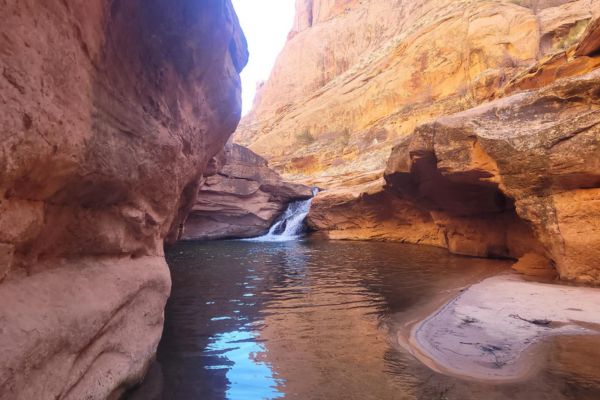
- Level: Moderate
- Length: 1.6 miles
- Estimated Time: 31 minutes
The Mill Creek Trail lies close to Moab, Utah’s southeast boundary. The path follows Mill Creek’s banks, drawing locals and tourists to its refreshing waters at a number of swimming holes.
The Mill Creek Waterfall is just over a mile from the trailhead. Many people jump from the overhanging cliff above the falls into the plunge pool there.
The petroglyphs and pictographs that adorn the walls of the canyon along Mill Creek bear witness to the various ancient occupants who left their imprints. This post takes you past the waterfall and up the north branch of the canyon trail to one of the primary rock art panels, which is located in an alcove above the creek.
Definitely worth the hike all the way to the waterfall!! Absolutely gorgeous!!! You will have to cross the stream, and if it’s flowing good, it could be about ankle deep. Wear good hiking shoes, some climbing is done! I did it alone and would absolutely do it again!!!
Blanca Cruz from AllTrails
Elevate Your Heart Rate With These Hard Hikes
If the adrenaline rush is what gets you going, these hard hikes in Moab are for you! These are for experts and hikers with long-time experience. Even though the trails are really hard to take, it’ll surely be worth it once you see the views and incredible rock formations.
Remember to always be careful when taking on these trails!
Fisher Towers Trail
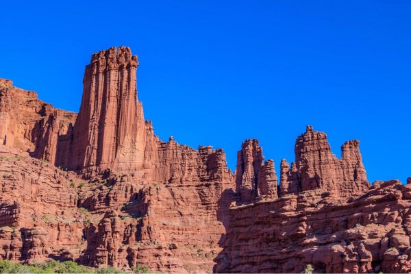
- Level: Hard
- Length: 4.2 miles
- Estimated Time: 2 hours and 46 minutes
One of the most unusual landscapes in Utah’s canyon country, the Fisher Towers are explored along the Fisher Towers Trail. East of Moab, the landscape is a tangle of towering fins, pinnacles, minarets, gargoyles, spires, and oddly shaped rock formations. Dark red Cutler sandstone with tougher Moenkopi sandstone on top and covered with mud curtains make up the towers, which are soaring monuments to erosion.
Beautiful hike outside of Moab. Nice little bonus to the parks. The hike can be quite challenging but so worth it.
Pspbeach from Tripadvisor
Slickrock Practice Loop
- Level: Hard
- Length: 2.2 miles
- Estimated Time: 50 minutes
The Practice Loop begins at the painted junction within a quarter mile into the main Slickrock Trail. Take a right at that junction.
After a succession of sandstone domes, follow the white dashes and make a swift descent to the Echo Canyon viewpoint. Follow the dashed line as it winds back towards the main route, making several short but sharp rises and declines as it winds up and over several low fins and across sandy washes.
For those looking to ease into the terrain, this trail offers a solid introduction to the kind found on the main loop, but at a more moderate elevation. However, it poses some serious challenges and must not be taken lightly.
Very…VERY challenging. Strenuous and physically challenging! But awesome.
Andrew Oakes-Lottridge from AllTrails
Slickrock Bike Trail
- Level: Hard
- Length: 8.9 miles
- Estimated Time: 3 hours and 36 minutes
The trail is an endless sequence of short but extremely steep ascents and descents. If you’re just starting out, start with the easier walks because falling on rock hurts more than falling on dirt.
The slickrock is Navajo Sandstone, and it’s made of petrified sand dunes from the Jurassic Period that date back 200 million years (yes, Moab is covered in dinosaur fossils). The original creators of the Slickrock Trail were dirt bikers in 1969. It’s extremely slippery for bike tires, but it’s not the same for horses with metal shoes, which is why early settlers called it “slick rock” in the 1800s.
This trail is not a beginner trail. There are very steep ascents and descents. Take lots of water the trail is nearly 100% unshaded. The views are great and you will likely see some 4×4’s doing near impossible things.
Clint H from Tripadvisor
Take On The Best Moab Hikes
Have you picked out what the best Moab hike is for you? There are hundreds of beautiful trails that are perfect for your next outdoor adventure, be it hiking, biking, trail running, or something else entirely. Enjoy going through this list of easy-to-hard hiking trails and see what hikers like you say about them.
Choose from kid-friendly hiking trails in Moab or find family-friendly routes for your upcoming vacation. Some of them are even pet-friendly!
Explore some of the historic sites along the pathways, or take an excursion through the adjacent nature regions, which are ideal for hikers and outdoor enthusiasts of all ability levels.
Best Hikes In Moab FAQs
What is the most famous hiking trail in Moab?
The most famous hiking trail in Moab is arguably the Delicate Arch Trail in Arches National Park. Delicate Arch is an iconic symbol of Utah and one of the most photographed natural arches in the world. The hike offers stunning views of the surrounding red rock landscape and culminates in the breathtaking sight of Delicate Arch standing against the horizon.
Is Moab good for hiking?
Absolutely! Moab is renowned for its exceptional hiking opportunities. With its diverse array of national parks, state parks, and other natural areas, Moab offers hikes suitable for all skill levels, from leisurely strolls to challenging treks. The unique red rock scenery, towering arches, and expansive canyons make hiking in Moab a truly unforgettable experience.
Are there easy hikes in Moab?
Yes, there are plenty of easy hikes in Moab suitable for beginners or those seeking a more leisurely stroll. Some examples include the Park Avenue Trail in Arches National Park, which offers an easy walk through a stunning canyon with towering rock formations, and the Dead Horse Point Trail in Dead Horse Point State Park, providing panoramic views of the Colorado River without significant elevation gain.
What is the most difficult hiking trail in Moab?
One of the most challenging hiking trails in Moab is the Devil’s Garden Trail in Arches National Park. This trail is known for its rugged terrain, steep drop-offs, and narrow sections with exposure to heights. The full loop, including primitive sections, can be demanding, especially in hot weather.