Air Or Land: The Best Way To Get To Moab And Experience An Unforgettable Trip
Table of Contents
Thinking of the best way to get to Moab in Utah? You have a few choices, including taking a flight to one of Salt Lake City’s or Denver’s international airports or taking a drive.
Moab is less than 50 miles from Colorado on the Eastern edge of Utah. Las Vegas is located in the west, Denver is to the east, and Salt Lake City is to the north. Once in Moab, we advise getting a rental car. You can rent a Jeep to go around as it’s more enjoyable!
Getting to Moab By Air
Several international airports are accessible from Moab in less than a full day of travel. International and domestic flights will frequently arrive at these major hubs.
You have two options for getting to Moab from the international airport: renting a car or connecting to a smaller regional airport. There are daily flights in Moab’s regional airports from and to the major international airports listed below.
International Airports
- Salt Lake City International Airport
- Denver International Airport
- Las Vegas International Airport
Regional Airports
- Grand Junction Regional Airport
- Montrose Regional Airport
- Vernal Regional Airport
- Canyonlands Field Airport
- Durango-La Plata County Airport
Getting to Moab By Land
The ideal location for a road trip is Moab. Moab is accessible from major cities in less than half a day’s drive. The best part is that no matter which direction you are traveling from or to Moab, there are a ton of sights along the road. Below is some information on the anticipated driving times going to Moab.
- From Salt Lake City – 4-hour drive
- From Denver – 6-hour drive
- From Las Vegas – 7-hour drive
If you don’t have your own vehicle going to Moab, that wouldn’t be a problem! Here are other transportation options you can use:
- Porcupine Shuttle
- Roadrunner Shuttle
- Moab taxi
There are buses and shuttles that will take you to Moab from each of the three airports, but renting a car is the most convenient option. While Moab’s center is very walkable, it might be challenging to reach the national parks and hiking trails in the surrounding area without your own vehicle.
The Scenic Destinations While on a Road Trip to Moab
An adventurer seeker’s fantasy can come true in Moab. But while getting there, you can also stop by numerous scenic destinations, particularly if you’re on a road trip.
Zion National Park
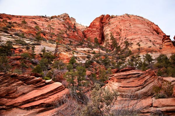
Zion National Park is not far from Las Vegas, Salt Lake City, or St. George in southern Utah, close to Springdale. It resembles a lavish movie set, a production where the art director is given complete creative freedom.
Zion was the ideal name for this magnificent canyon since, to the Mormon pioneers, it meant a heavenly city. Together with “Angels,” “Temples,” and “Thrones” among the enormous sandstone formations, the subject is perpetuated. They are all the ideal backdrop for a wide range of adventure and escape, serenity, and solitude.
Prepare yourself for a genuinely spiritual experience if you are in the park between sunrise and sunset.
Bryce National Park
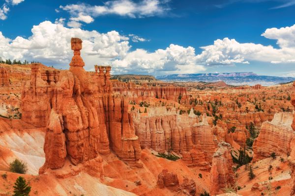
In southwest Utah, Bryce Canyon National Park is only an hour and a half’s drive from Zion National Park. Rock strata cross the rows of human-shaped pillars in an almost deliberate, yet perfectly strange, manner. Very serene, unsettling, and lovely. You might think that the place is so unlikely to be real.
Bryce Canyon requires you to get out of the car to take Instagram-worthy pictures. Since the canyon is entered from above, any forays inside will need some effort to exit. With its towering green ponderosa pines and colorful “hoodoo” sandstone spires, Bryce is a place of contrasts.
The Golden Mantled Ground Squirrel, one of the most compelling panhandlers you have ever encountered, is another possibility. Despite what these animals try to convince you, they don’t need your cheese puffs!
There are also surrounding trails and attractions like “Thor’s Hammer” and “Mossy Cave.”
Manti La-Sal National Forest
Three mountain blocks in central and southeast Utah make up the Manti-La Sal National Forest.
The La Sal and Abajo mountain ranges of the forest serve as picturesque backdrops to state and national parks in the desert regions of southeast Utah and offer good chances for hiking and mountain climbing.
Excellent camping, fishing, hunting, and thrilling ATV and off-road trails may all be found in the Wasatch Plateau. The Energy Loop, a national scenic byway that travels through the Huntington and Eccles Canyons, is located north of the Wasatch Plateau region. At elevations of 5,000 to 11,000 feet, these woodland byways wind over the Plateau. Among the forest’s energy-related features are a power station, a coal mine, and gas exploration wells.
In addition to offering access to some excellent fishing opportunities and breathtaking scenery, the Wasatch Plateau region of the Manti-La Sal Forest has a number of recreation trails for foot, horse, and/or mountain bike traffic. This region is also where the fabled “Huntington Mammoth” was discovered.
The Abajo Mountains, which rise 11,360 feet above sea level, and the nearby red rock plateaus are both scenically stunning and rich in historical significance. But the imagination can run wild over pictographs, petroglyphs, cliff dwellings, arrowheads, and pottery left by Anasazi Indians and those who came before. Sites dubbed “Deadman Point,” “Babylon Pasture,” or “Chippean Rocks” conjure colorful legends of the early West of the white man.
The La Sal Mountains are located close to Moab along the eastern Utah border and climb 12,721 feet above sea level. The Colorado River Plateau’s arid receives climate respite from this region of the forest. Travelers can access high mountain passes via narrow forest roads. They can also enter minor valleys like Dark Canyon, where the crystalline rock structure of the peaks is visible, or Mill Creek, where Oowah Lake is nestled among spruce trees like a tiny jewel.
The La Sal Mountain Loop Road Scenic Backway offers breathtaking views of the red sandstone landscape below and the forested heights of the La Sal Mountains. The Upper Colorado River Scenic Byway U-128 is located at the end of this paved Scenic Backway, which starts on US 191 six miles south of Moab and winds north over the La Sal Mountains via Castle Valley. A 60-mile circle drive that takes around 3 hours leads back to Moab.
Uinta-Wasatch-Cache National Forest
The Uinta-Wasatch-Cache National Forest spans 2.2 million acres in southwest Wyoming and northern Utah. It is one of the most popular forests in the country, with 9 million tourists a year.
In the Uinta-Wasatch-Cache National Forest, man and nature coexist in harmony. Some of the fastest expanding regions in the Intermountain West are metropolitan centers and settlements that border forests.
The Uinta Wasatch Cache is a heavily frequented site from backyard to backcountry because it is easily accessible year-round. You can access scenic landscapes, natural surroundings, fresh water, and pure air via roads and paths. The “Greatest Snow on Earth” attracts tourists from all over the world during the winter.
Mesa Verde National Park
Mesa Verde, or “Green Table” in Spanish, is a national park in southwest Colorado that provides an unrivaled opportunity to view and experience a distinctive cultural and natural environment. This national treasure safeguards the cliff dwellings and mesa top sites of pit houses, pueblos, masonry towers, and farming buildings of the Ancestral Pueblo people who inhabited this area for more than 700 years. It includes more than 4,000 known archeological sites that date back to A.D. 550.
The cliff dwellings are among the country’s most famous and well-preserved historical attractions. The Ancient Pueblo people started constructing structures beneath Mesa Verde’s oblique cliffs after 600 years of mostly inhabiting the mesa top. These structures ranged from one-room storage units to cities with more than 150 rooms. The Ancient Pueblans were skilled survival and artistic craftsmen, but decades of excavation and investigation have left many unsolved.
Mesa Verde National Park was recognized as a UNESCO World Heritage Site in 1978 for its remarkable archaeological significance. Mesa Verde National Park is positioned high in Southwest Colorado, where the air is light, the history is rich, and the views are breathtaking, protecting thousands of historical monuments, including hundreds of cliff dwellings.
Lake Powell
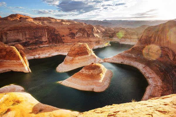
Swimming and boating may be added to the hiking, camping, and sandstone dynamics you’ve anticipated from southern Utah, thanks to Lake Powell‘s calm blue water, which flows directly into sand beaches. Since the flooded canyons resemble the federally designated areas that surround them so closely, it has been dubbed “America’s lost national park.” You can enjoy the same amber-, tangerine-, and red-rock views by boat. It is the desert but without the extreme dryness!
This aquatic paradise begs to be explored because it has more shoreline than the entire west coast of the United States. But, you will need a boat, which you can hire or charter from the marina, to enjoy this tall watering hole truly. Instead, use a kayak or stand-up paddleboard to get active.
Once you’re on the water, you’ll see right away why this location was selected as the setting for the first Planet of the Apes; it truly is out of this planet.
Note: Depending on the water level, access to different sites of Lake Powell might change drastically. For information on current circumstances, marina availability, etc., contact the National Park Service.
San Juan Skyway in Colorado – Durango, Ouray, Silverton, Telluride
The San Juan Skyway Scenic and Historic Byway in Colorado, which passes through well-known mountain towns including Durango, Silverton, Telluride, and Ouray, is frequently regarded as a must-drive route for road trippers. It travels through the stunning, multicolored San Juan Mountains and stops at historic cities of considerable significance.
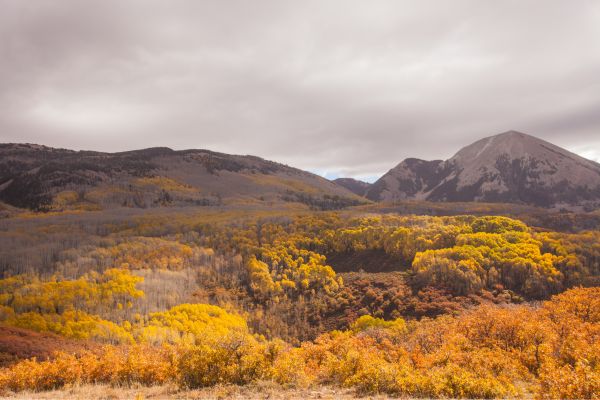
The byway traverses five million acres of the San Juan and Uncompahgre National Forests. You will pass through high mountain passes, storied towns, waterfalls, and vast fields of wildflowers as you travel the length of the byway. The aspen trees display vibrant hues in the fall.
The San Juan Skyway is well-known around the world for its breathtaking vistas. The byway finally makes a circle to the south and travels through Mesa Verde and Dolores National Parks, home to the renowned Ancient Puebloan cliff houses.
Learn The Best Way To Get To Moab Now
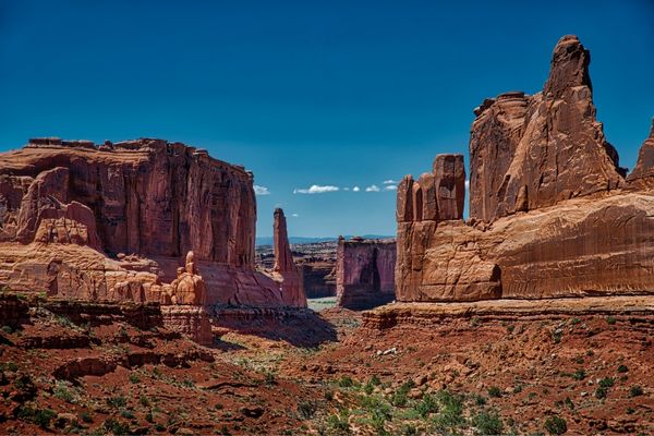
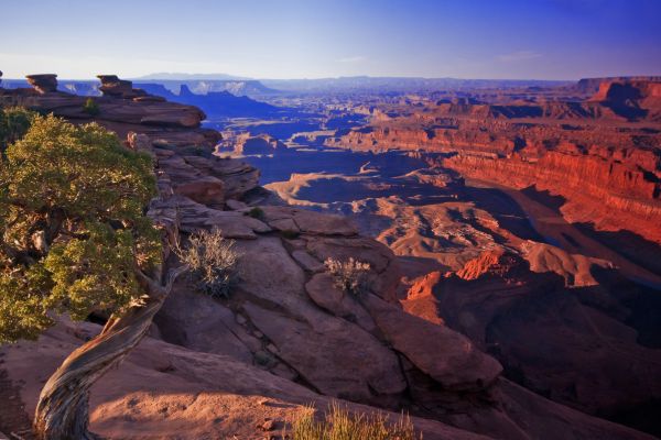
Since there is so much hiking between Canyonlands and Arches National Park, you could stay in Moab for weeks and weeks. We’re talking hundreds of miles of clearly delineated paths here. And that’s not even considering the world-class off-roading and mountain biking the area offers.
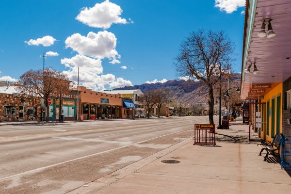
Before you ask, “how many days do you need in Moab,” consider what it is that you actually want to accomplish on your trip. Don’t forget to experience the local Moab restaurants, and go on a few heart-pounding whitewater excursions!
Best Way To Get To Moab FAQs
How do people get to Moab?
Thinking of the best way to get to Moab in Utah? You have a few choices, including taking a flight to one of Salt Lake City’s or Denver’s international airports or taking a drive.
Moab is less than 50 miles from Colorado on the Eastern edge of Utah. Las Vegas is located in the west, Denver is to the east, and Salt Lake City is to the north. Once in Moab, we advise getting a rental car. You can rent a Jeep to go around as it’s more enjoyable!
What is the closest international airport to Moab?
You have two options for getting to Moab from the international airport: renting a car or connecting to a smaller regional airport. Salt Lake City International Airport is the closest one to Moab. Several international airports are accessible from Moab in less than a full day of travel. There are daily flights in Moab’s regional airports from and to the major international airports.
What airport do you fly into for Arches National Park?
Most visitors to Arches arrive at one of these airports:
– Canyonlands Field
– Grand Junction Regional Airport
– Salt Lake City International Airport
If you plan to go to Arches by car, the north of Moab is where you’ll find the entrance.
What is the closest big city to Moab?
Las Vegas is located in the west, Denver is to the east, and Salt Lake City is to the north. Moab serves as the geographic hub of the untamed, magnificent wilderness thanks to the nearby national parks of Arches and Canyonlands as well as the La Sal Mountains.
How many days are enough in Moab?
Since there is so much hiking between Canyonlands and Arches National Park, you could stay in Moab for weeks and weeks.
Before you ask, “how many days do you need in Moab,” consider what it is that you actually want to accomplish on your trip. Set aside at least four or five days if you want to visit both parks, experience the local Moab eateries, and go on a few heart-pounding whitewater excursions!
Can I visit Moab without a car?
If you don’t have your own vehicle going to Moab, that wouldn’t be a problem! There are several transportation options, like shuttles and taxis.
Some buses and shuttles will take you to Moab from each of the three airports, but renting a car is the most convenient option. While Moab’s center is very walkable, it might be challenging to reach the national parks and hiking trails in the surrounding area without your own vehicle.