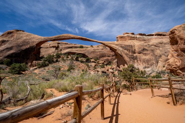
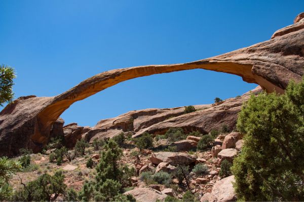
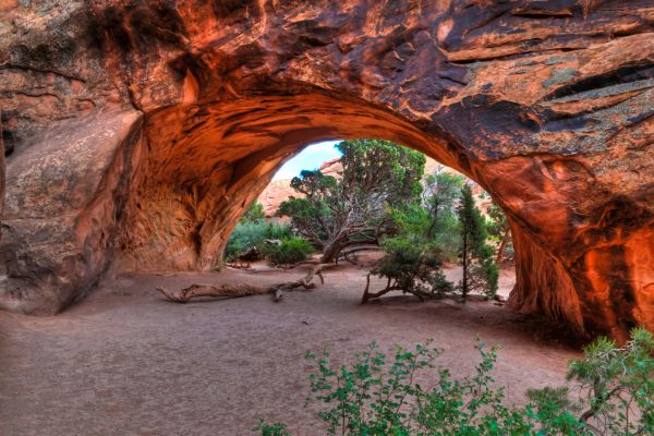
The Landscape Arch Trail is indeed one of the highlights of Arches National Park in Utah, renowned for its stunning natural arches and rock formations. The trail leads to Landscape Arch, one of the longest natural arches in the world, stretching over 300 feet across.
If you’re a beginner, the Landscape Arch Trail might become one of your favorite hikes in Moab because it’s short and gives you the opportunity to witness incredible natural wonders. Arches National Park typically receives over a million visitors each year, and the Landscape Arch Trail is a must-see attraction for many of them.
Here’s what you need to know about Landscape Arch Trail before a memorable hike.
Table of Contents
Map Of Landscape Arch Trail
About Landscape Arch Trail, Arches National Park
- Address: U.S. 191, Moab, UT 84532
- Trailhead GPS: 38.782814, -109.594988
- Website: nps.gov/places/landscape-arch-trail.htm
- Hours: Open year-round, 24 hours a day
- Arches National Park Admission: Per Person: $15 | Motorcycle: $25 | Private Vehicle $30
- Amenities: Bicycle rack, vehicle parking, vault toilets, Trailhead, trash cans, potable drinking water
- Level: Easy
- Length: 1.9 miles
- Estimated Time: 49 minutes
With a light opening of 306 feet (93.3 meters), the Landscape Arch is the longest arch in North America. This breathtaking expanse measures about 6 feet (1.8 meters) in diameter at its narrowest. In the 1990s, large sections of the arch collapsed, demonstrating how quickly the park’s terrain may alter radically. The Landscape Arch is hanging on by a very thin thread, even while nearby arches have collapsed.
Landscape Arch is situated in the upper region of Arches National Park, off Arches Entrance Road, at the end of the well-kept Devils Garden Trail. The Devils Garden area has an incredible number of arches and other natural sculptures. If you’re an experienced hiker, you might want to check them out as well!
Guided Tour Of Landscape Arch Trail
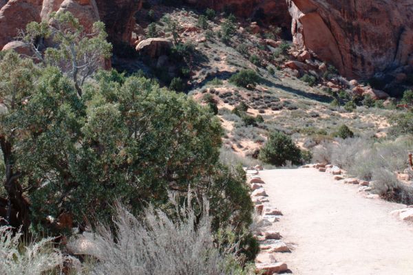
The Devils Garden trail winds through an amazing panorama of sandstone knobs, spires, and fins in Arches National Park. Access to Landscape Arch is provided by a well-traveled trail that begins at the park road’s northernmost point.
By the time you reach the north end of the road, you will have viewed all of Arches’ natural beauties, including cliffs, hoodoos, and, of course, arches of every form and size, from your car window. All of these attractions may still be visited at Devils Garden. For this reason, the short walk to the arch is just as enjoyable as the arch itself.
The mile-long route is well-graded, easy to follow, and frequently packed with people as it meanders through a variety of softly sculpted rock formations. This trail’s popularity can be attributed to its minimal elevation, making it appropriate for a wide range of users.
If you’re feeling particularly daring, you may even continue past Landscape Arch into the roughest area of Devils Garden, where you’ll find slot canyons, cliffs, and even more arches.
What To Expect on Your Hike
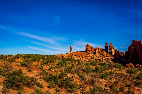
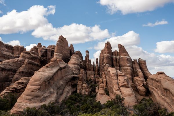
Arches, spires, and a significant concentration of thin rock walls known as “fins” can all be found in Devils Garden. Rainwater erodes parallel fissures brought on by the uplift of salt deposits beneath the surface to generate fins. Eventually, fins dissolve and make room for the creation of arches such as Devils Garden’s crown jewel, Landscape Arch.
In 1991, when loud cracking and popping noises sent those sitting beneath the arch scurrying, the arch was nearly five feet thicker. Before long, fragments of the arch started to fall, and a 60-foot-long rock slab suddenly appeared from the underside of the narrowest part of the arch. When the dust settled, 180 tons of new rock debris were strewn beneath the bridge.
Fortunately, nobody was harmed. Hiking beneath the arch is no longer allowed due to safety concerns.
Tip: To make the most out of your hike, take pictures at some famous roadside landmarks in the Arches National Park.
How To Find The Landscape Arch Trail Trailhead
The Landscape Arch Trail is a must-do short hike that leads to Arches National Park’s longest arch and two additional huge arches.
Note: The trailhead is where the road ends and forms a small loop. Stay on the loop to avoid entering the Devils Garden Campground.
Proceed 19 miles northward on the main road into the park and park in the spacious lot at the Devils Garden Trailhead. The trailhead is located near a bulletin board and bathrooms at the north end of the parking area.
What Time is The Busiest?
One of the largest rock spans in the world, Landscape Arch, is a well-liked attraction in the park and is frequently extremely crowded. But this shouldn’t stop you. The 290-foot-span narrow ribbon of Entrada sandstone is a spectacular arch that is well worth the short, simple climb.
Like many popular hiking trails in Arches National Park, the busiest time for the Landscape Arch Trail tends to coincide with the peak tourist season. This typically occurs during the spring and fall months when the weather is milder and the park is more accessible for outdoor activities.
Please note that the parking area fills quickly during busy hours.
Flying A Drone (Is It Allowed?)
Flying drones in national parks, including Arches National Park, where the Landscape Arch Trail is located, is generally prohibited. The National Park Service (NPS) has regulations in place that restrict the use of drones to protect wildlife, preserve the natural environment, and maintain the visitor experience.
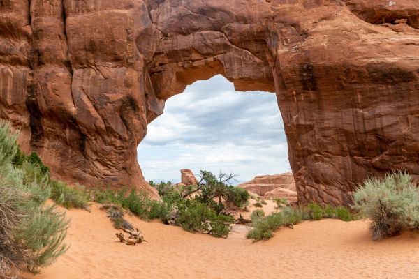
Other Hikes Close To Landscape Arch Trail
Devils Garden is Arches National Park’s adventure playground and undoubtedly one of the top hikes in the park. Eight breathtaking arches can be viewed from its pathways. The Devils Garden layout allows you to access each arch via a different trail; the most well-liked hike is to Landscape Arch.
For more details, see the descriptions of the trails near Landscape Arch below.
Pine Tree Arch Trail
- Level: Easy
- Length: 0.9 miles
- Estimated Time: 30 minutes
Pine Tree Arch is at the end of a short spur trail with the same name that branches off from the main trail 0.3 miles (0.5k) from the Devil’s Garden Trailhead and travels 0.2 miles (0.3k) to Landscape Arch.
While some visitors make an effort to walk over to the Pine Tree and Tunnel arches, many only manage to see the Landscape Arch when they visit the Devil’s Garden site. The trail is suitable for year-round use and is well-maintained with gravel. The surrounding vegetation makes hiking around the sandstone cliffs more pleasant and enjoyable.
Tunnel Arch Trail
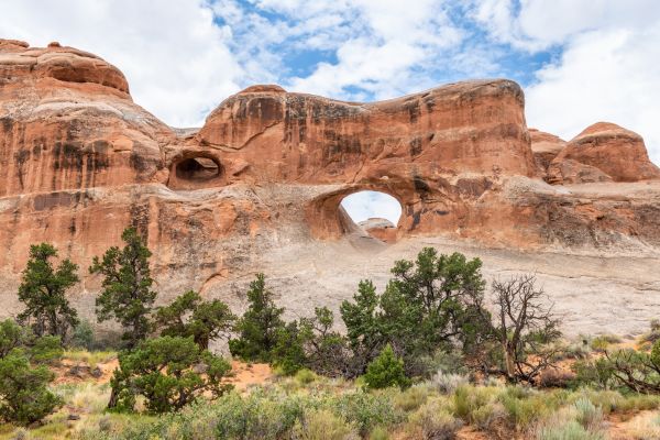
- Level: Moderate
- Length: 0.7 miles
- Estimated Time: 22 minutes
Walking to Landscape Arch alone will make this hike 1.9 miles; if you continue on, you’ll see two more arches and cover 2.5 miles. The largely flat hike continues for about ⅓ mile, after which you can make a sharp right to reach Tunnel Arch. After that, the branch goes on to Pine Tree Arch. You can pass beneath arches like this one.
The short out-and-back Tunnel Arch Trail is an enjoyable experience for the whole family. Bring lots of water and sunscreen for yourself and your hiking companions because this hike is hot and sandy in the desert sun.
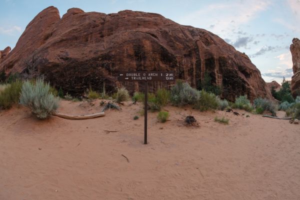
Double O Arch Trail
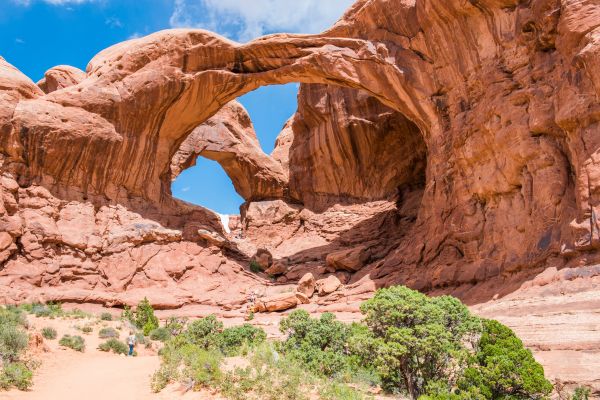
- Level: Moderate
- Length: 4.1 miles
- Estimated Time: 1 hour and 53 minutes
With Landscape Arch obviously coming in first, Double O Arch is the second biggest arch in the Devils Garden area. This location has two arches, as the name suggests. A large arch, spanning 71 feet, is stacked atop a much smaller arch, measuring just 21 feet. Both belong to the same fin of sandstone.
Double O Arch is 1.93 miles past the Devils Garden trailhead and parking lot at the north end of Arches Entrance Road, at the far end of the Devils Garden Primitive Loop, less than a mile beyond Landscape Arch. Once you pass Landscape, the trail gets much rougher and more difficult here.
Partition Arch Trail
- Level: Easy
- Length: 2.8 miles
- Estimated Time: 1 hour and 18 minutes
The Partition Arch Trail trailhead is located off Highway 191 at the end of Main Park Road, about 29.0 km from the Arches Visitor Center.
It’s unfortunate that this trail provides very little shade and can get very hot in the sun, so pack more water, a good sunhat, and extra sunscreen.
The Partition Arch Trail is a fantastic option for families with children or novice hikers because it is frequently used and well-maintained. This trail passes the remains of Wall Arch, an impressive formation that collapsed in the summer of 2008, and Landscape Arch.
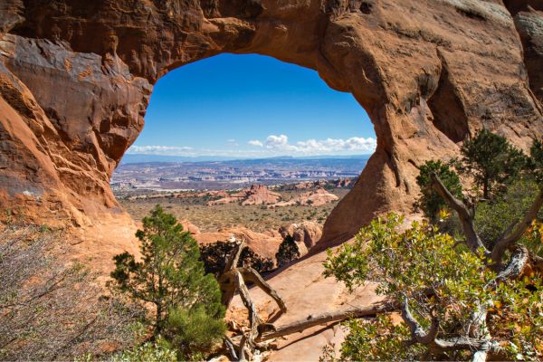
Navajo Arch Trail
- Level: Easy
- Length: 2.9 miles
- Estimated Time: 1 hour and 21 minutes
You will need to hike through Devils Garden Trailhead to reach the Navajo Arch. The trail is not too difficult until you cross Landscape Arch. After that, the trail starts to climb steadily, and you’ll have to scramble and ascend slickrock fins.
A short distance ahead of you, approximately 1.2 miles west of the Devils Garden Trailhead, is the Navajo Arch Spur Trail, which splits off from the Primitive Loop. Turning left will lead to Partition Arch, and going straight will lead to Navajo Arch. Proceed on the path in the direction of the Navajo Arch.
Trees surround the arch, and a pine tree is growing beneath it, which is one of the first things you’ll notice. The trees and arch provide lots of shade to allow you to unwind and take in the surroundings.
Dark Angel
- Level: Moderate
- Length: 4.7 miles
- Estimated Time: 2 hours and 6 minutes
Situated half a mile northwest of Double O Arch and at the western end of the Primitive Loop Trail stands the 150-foot sandstone tower known as The Dark Angel. Perched on a small hilltop overlooking Devils Garden, it stands watch over the garden’s arches and fins. This section of the park features a singular formation that is a massive obelisk encircled by fins, arches, and canyons.
Dark Angel can be found 2.34 miles north of the Arches Entrance Road, past the Devils Garden Trailhead and parking lot.
Primitive Loop Trail
- Level: Hard
- Length: 7.9 miles
- Estimated Time: 3-4 hours
This becomes the longest maintained trail in Arches National Park if you follow the Primitive Loop Trail and all of the short spur trails to neighboring arches and other features. The NPS has marked it as “Caution, primitive trail, difficult hiking.” In addition, it’s among the most breathtaking hikes in any national park.
The full loop can be hiked in three to four hours, but you could also take a whole day to explore the area and unwind along the way. Either way, bring extra water. You might want to take this hike early in the morning to avoid the heat.
What to Bring On Your Hike
When preparing for a hike on the Landscape Arch Trail in Arches National Park, it’s essential to pack appropriately to ensure a safe and enjoyable experience. Here’s a list of items you should consider bringing:
Water: Staying hydrated is crucial, especially in Arches National Park’s desert environment. Bring an adequate supply of water for each member of your group. You might want to bring extra if you plan to hike trails inside Devils Garden other than the Landscape Arch Trail. The National Park Service recommends at least one gallon of water per person per day for hiking in the desert.
Sun Protection: The sun can be intense in the desert, so bring sunscreen with a high SPF rating to protect your skin from sunburn. Additionally, consider wearing a wide-brimmed hat and sunglasses to shield your face and eyes from the sun’s rays.
Appropriate Footwear: Choose sturdy, closed-toe shoes or hiking boots with good traction for navigating the trail’s rocky terrain. Avoid wearing sandals or flip-flops, as they offer little protection and stability on uneven surfaces.
Snacks/Energy Food: Pack lightweight, non-perishable snacks to fuel your hike. Trail mix, granola bars, and fresh fruit are good options for providing quick energy and sustaining your endurance on the trail.
Map and Compass: While the Landscape Arch Trail is relatively easy to follow, it’s always a good idea to carry a map of the park and a compass or GPS device in case you need to orient yourself or navigate off-trail.
First Aid Kit: Bring a basic first aid kit containing items such as adhesive bandages, antiseptic wipes, pain relievers, and blister treatment supplies. Be prepared to address minor injuries or discomforts that may arise during your hike.
Weather-Appropriate Clothing: Check the weather forecast before heading out and dress in layers to accommodate temperature changes throughout the day. Even in warmer months, temperatures can fluctuate significantly in the desert, so be prepared with a lightweight jacket or long-sleeved shirt for cooler mornings or evenings.
Camera/Smartphone: Don’t forget to bring a camera or smartphone to capture the stunning scenery along the trail. Landscape Arch and the surrounding rock formations provide plenty of opportunities for memorable photos.
What People Are Saying About Landscape Arch Trail

This is one of the most fragile arches in the park and as such you can’t actually get to it, but the trail leads you along the sand to a perfect viewpoint where the arch is highlighted by the blue sky behind it.
Richard N – Tripadvisor
Great easy trail! Landscape Arch ended up being my favorite arch we saw. Easy ups and downs to get out there. Added on Tunnel Arch and Pine Tree Arch which were worth the detour.
Melissa Moulton – AllTrails
Despite the rush though, this was still a wonderful hike. It’s hard for the landscape of Arches to disappoint and we enjoyed every last minute we had to experience it.
Dan Weemhoff – dwhike
Discover Landscape Arch, Utah
Located within Arches National Park, Landscape Arch is one of the most remarkable geological formations in the world. It is definitely worth visiting, especially if you’re fascinated by natural wonders and breathtaking landscapes.
The hike to Landscape Arch is relatively short and easy, making it accessible to a wide range of visitors. It’s a great option for families, casual hikers, and anyone looking to experience the beauty of Arches National Park without a strenuous trek.
Landscape Arch is a favorite subject for photographers due to its unique shape and dramatic setting. So, prepare your cameras and take photos as your souvenir from hiking the Landscape Arch Trail.
Landscape Arch Trail FAQs
How long is the Landscape Arch Trail Arches National Park?
The Landscape Arch Trail is approximately 1.9 miles round trip. It’s a relatively easy and accessible hike suitable for visitors of various ages and fitness levels.
Is Landscape Arch the longest in the world?
Landscape Arch is one of the longest natural stone arches in the world, with a span of approximately 290 feet (88 meters). While it’s not the absolute longest, it is one of the most impressive due to its delicate, slender form.
Did Landscape Arch fall?
Landscape Arch has not fallen. However, like all natural arches, it is subject to erosion forces and could collapse in the future. The last significant documented collapse of a major arch in Arches National Park was the Wall Arch in 2008.
How was Landscape Arch formed?
Like other natural arches in Arches National Park, the Landscape Arch was formed through erosion. Over millions of years, water, ice, wind, and chemical weathering gradually wore away at the sandstone rock layers, creating natural arches, fins, and other geological features. In the case of Landscape Arch, the erosion process primarily involved the gradual widening and deepening of a vertical crack in the rock until it formed the elongated, thin span we see today.